The Hoy-Ensz Theory
A Theory Regarding the Break-up
Of Pangaea and Gondwanaland
A quick summary:
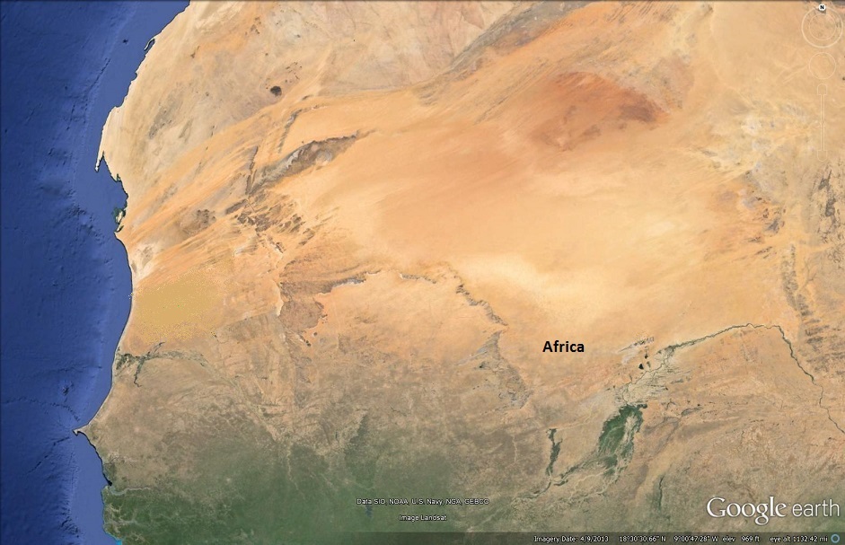
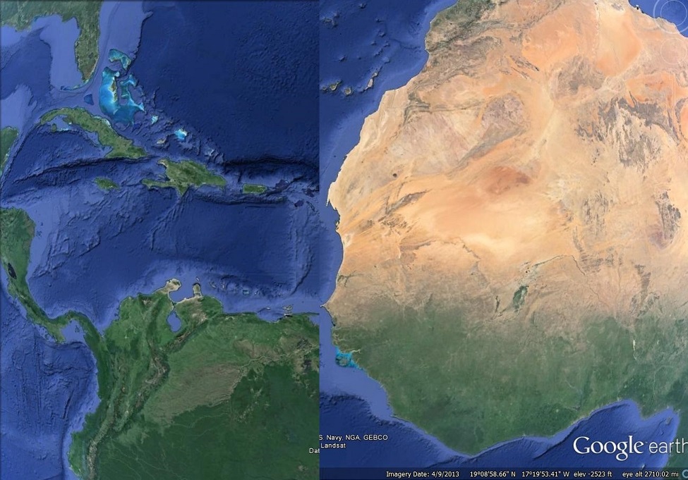
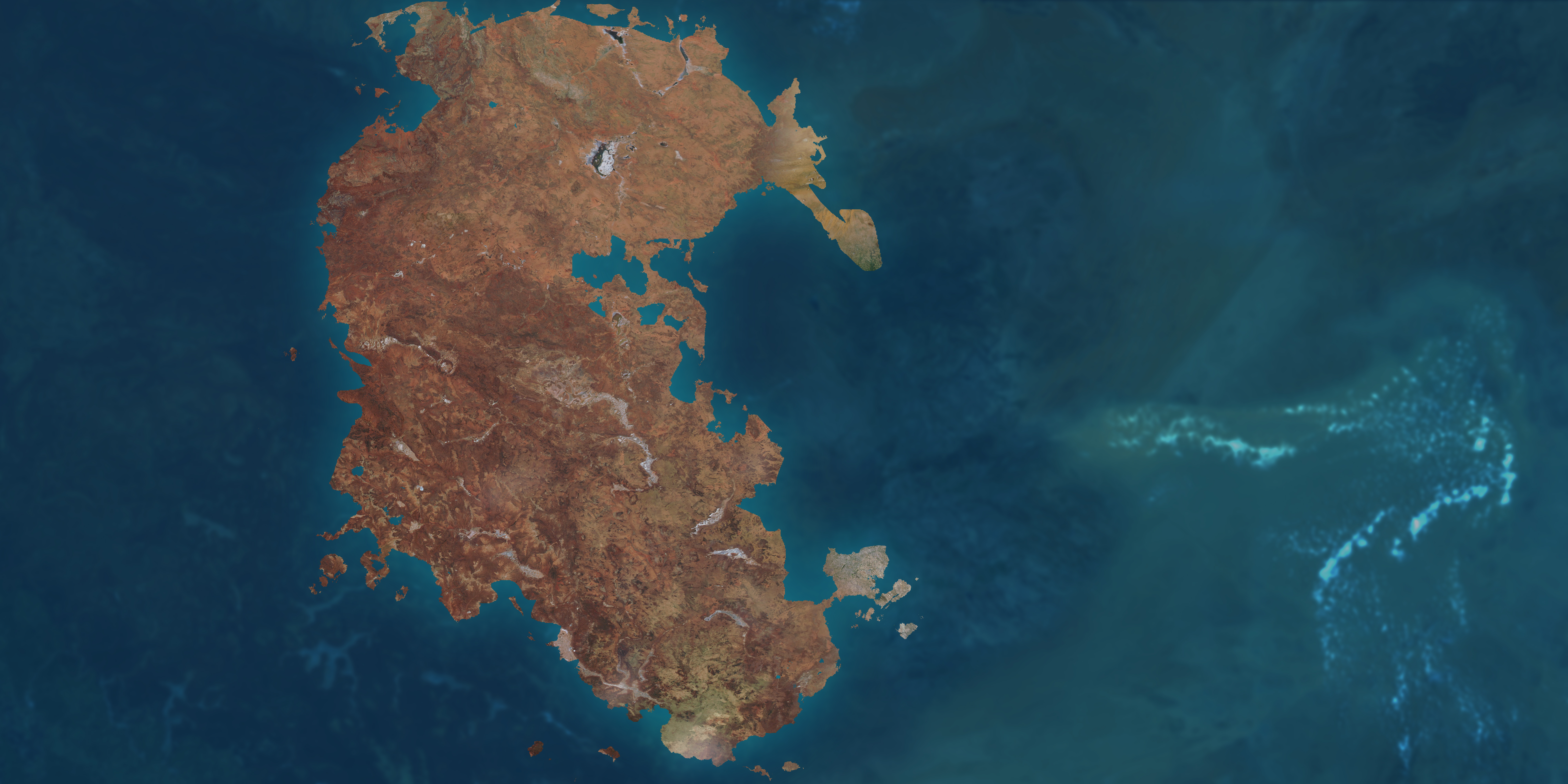
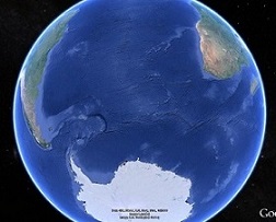
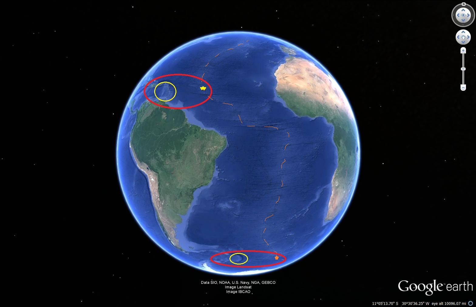
The picture below is of the western coast of Africa (courtesy of GoogleEarth/NASA). In particular, it is of the country of Mauritania:
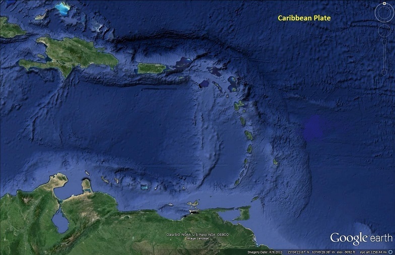
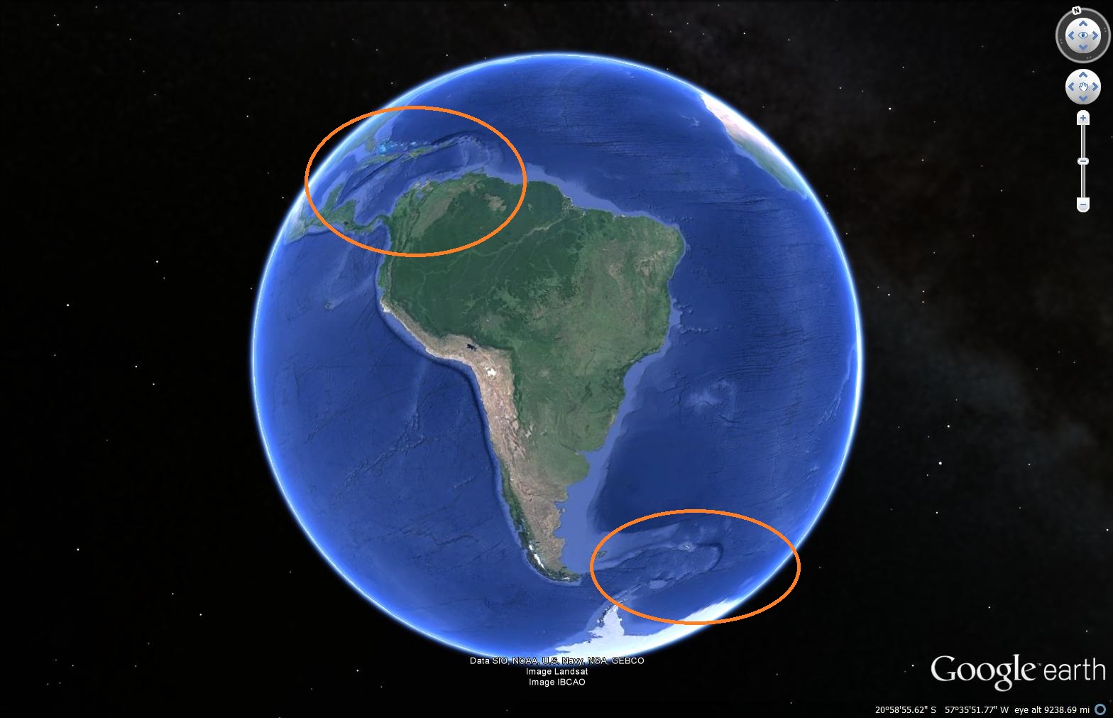
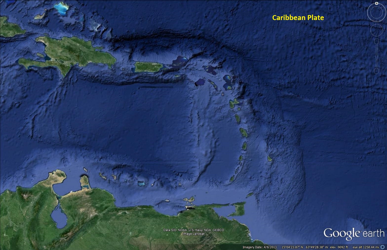
The next picture is of the northern part of South America, in particular the Caribbean Sea, from about the same distance and orientation as the picture above:
And, their current relationship to each other.
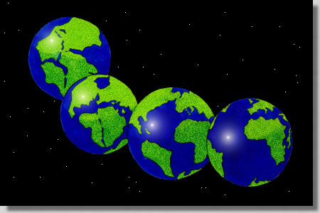
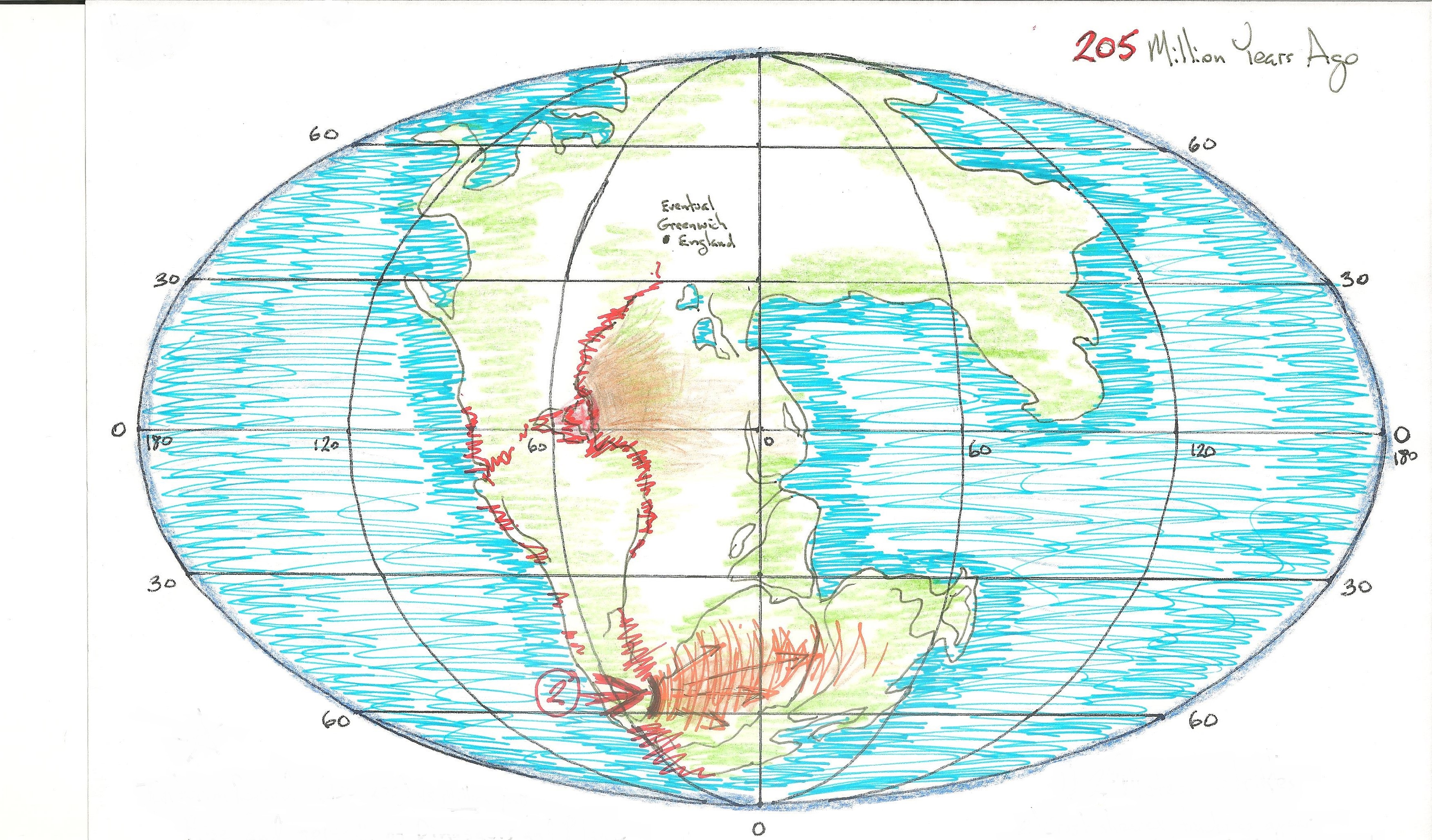
However, 250 Million years ago they were much closer together. In fact they were part of one very large piece of heavily vegetated land that was inhabited by a variety of creatures (big and small) both on land and in the surrounding seas – fish, insects, small mammals, and pre-dinosaurs. This land was called Pangaea.
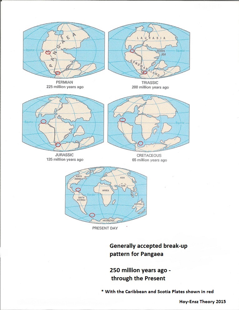
Most Pangaean theorists are in agreement with this generalized depiction of the super-continent as it appeared about 250 million years ago:
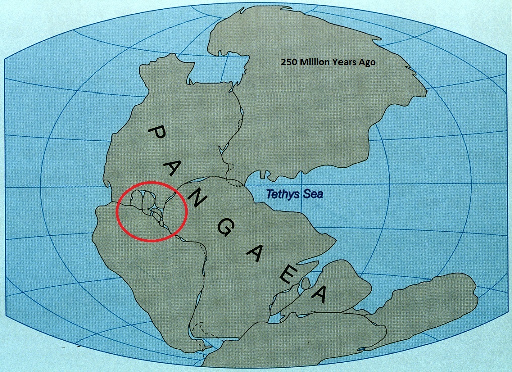
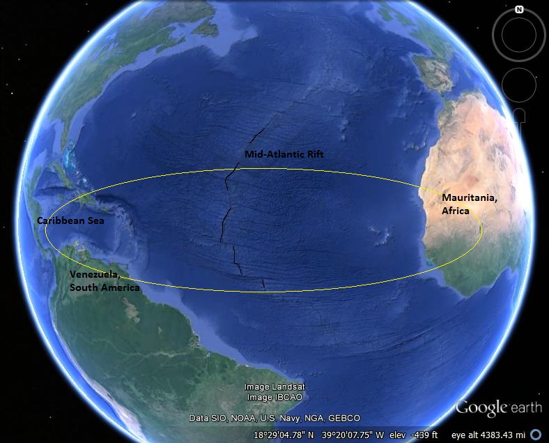
The red circle encloses an area that I have found interesting. Mauritania, the Caribbean Sea, and the eventual start of the Mid-Atlantic Rift are all within its borders.
The current theories regarding the “breaking-apart” of the Pangaean continent center around heat related forces created by magma movement deep underground. These sub-surface movements forced cracks to form in the crusty surface – followed by subduction currents that “led” the present day continents away from each other and into their current positions – aided by the constant flow of magma out of the Mid-Atlantic Rift, which continues to separate America and Europe by inches each year.
The Hoy-Ensz Theory, as an alternative, states that a large object (meteor, asteroid, or comet) hit the Earth about 250 million years ago: forming the Caribbean Sea, causing the destruction of Northern Africa, and causing the crack that becomes the Mid-Atlantic Rift… THEN, subduction starts to move the continents.

In the composite picture below, I have super-imposed current pictures of the Caribbean area and Western Africa back into their Pangaean positions 250 million years ago – just after the impact crater has settled, but before the full formation of the Mid-Atlantic Rift, and the resulting break-up of Pangaea.
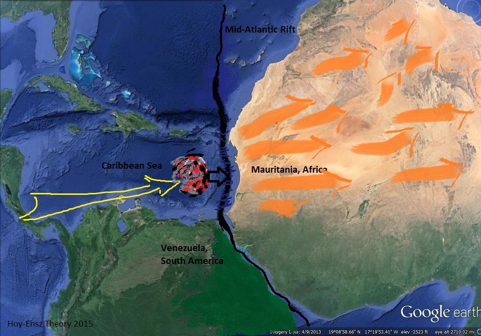
Notice the lining up of the fracture areas, the position of the “trench” that defines the Caribbean Sea, and the devastation that is still North Africa.

I believe this to be reasonable evidence of an impact crater, its debris field, and an impact point at which a fracture has a reason to begin.
***** That was the “quick and dirty” summary. Below is the detailed version:
There are a multitude of theories, studies, and scientific papers regarding the break-up of both Pangaea, and the subsequent southern region that many call Gondwanaland.
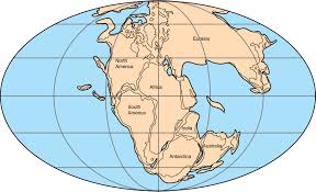
Pangaea from: myteacherpages.com, and an Artist’s rendering.
Ninety-Nine percent of them describe large-scale volcanic events which formed fiery plumes along a north/south fracture-line that would eventually become known as the Mid-Atlantic Ridge (MAR). These volatile events slowly pushed the separate continental plates apart, causing zones of subduction and magmatism which continued to gain their own momentum, and even now, continue the process of separation and Continental Drift. In the case of Gondwanaland, (a southern mass of rock that survived from the initial break-up of Pangaea, and mainly consisted of what would become S. America, Africa, Antarctica, India, and Australia), the explanation is comparable, but both India and Australia are seen to move in rather linear directions (for such large land masses) across the seas – for reasons that still seem to be elusive in almost all of the available hypothetical re-creations.
I propose that volcanic activity was not the cause of either event, but that it was a reaction to different, even larger events. Events capable of causing a deep rift in the land mass of Pangaea with enough energy left over to send Australia ‘speeding’ (albeit in very slow-motion) across the seas – and giving India, enough momentum to form the Himalayan Mountains as it “slammed (very, very, slowly also)” into the Asian mainland (the momentum still continues the mountain elevating process).
***
The majority of studies and animations put the fragmenting of Pangaea, and the beginning of the formation of the Mid-Atlantic Ridge (MAR), at approximately 250 million years ago. It starts in the Caribbean Sea area and spreads north and south, with the splintering of Gondwanaland following at about 50 million years later (beginning just east of the southern tip of South America). Increasing geological evidence backs-up those respective time frames.
A representative view of the Pangaea break-up from: Hodnett-ap.wikispaces.com
I am a Fan of GoogleEarth and must confess that I have spent many, many, hours perusing the geography of the planet from almost every altitude and perspective available. I would trace the paths of the ridges on the ocean floors, and I could only imagine the massive forces that must have been created, and released, during the fragmenting of such a huge land mass (Pangaea), and its’ continuing expansion/subduction process.
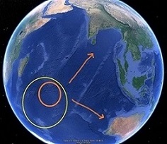
I kept being drawn back to two main tectonic plates that are strikingly similar – in fact, they are the only tectonic plates (of the dozen or so available) that are even remotely alike.
The first major distinction is that, in both cases, their eastern “rims are very distinct semi-circular arcs of (mostly extinct) volcanic ridges. Then, they are of similar sizes, but small compared to the other plates. They are both elongated-oval shaped (approx. 1,500 miles x 450 miles), and most curiously, they lie almost perfectly parallel to each other at the northern and southern tips of South America (15, and 55 degrees latitude respectively).
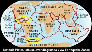
Tectonic Plate map from: eduweb.com
These Tectonic Plates are called the Caribbean, and the Scotia Plates, and my view is that they were uniquely shaped by the exact same type of external force. And, that when they were formed (though possibly at different geological times), the force and energy involved led to the explosive break-up of Pangaea, and then later, the similar forceful fracturing of Gondwanaland.
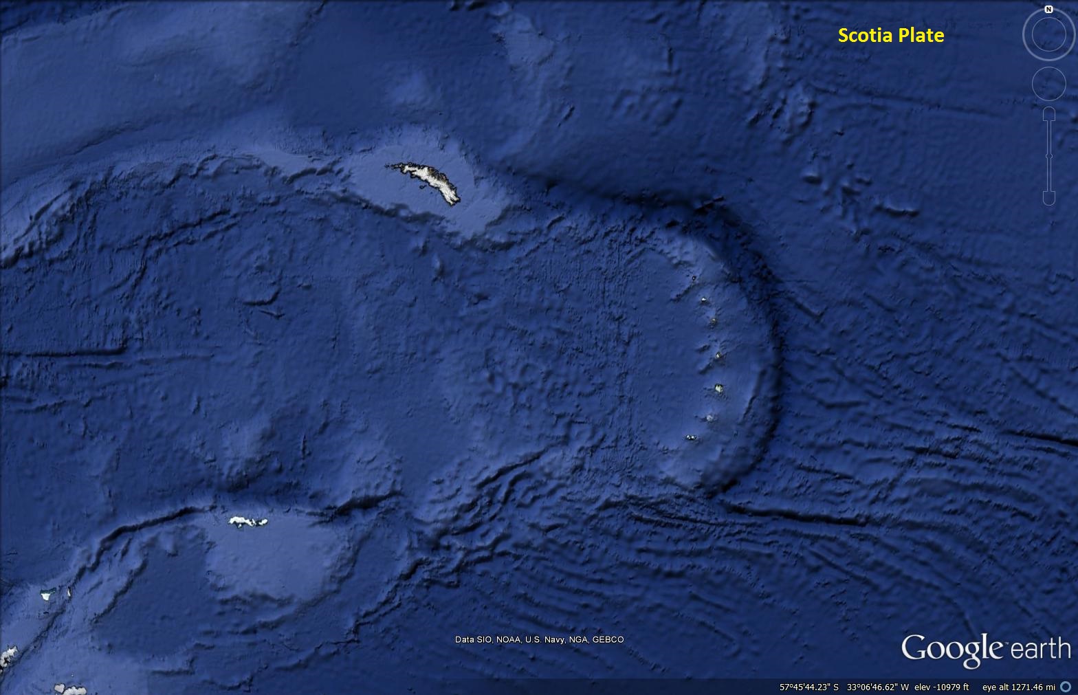
The Caribbean and Scotia Plates viewed from about 1,250 miles up, and with the same compass orientation.
My theory is that at a meteor, of considerable size (maybe 400 miles across), struck Pangaea, from a west to east direction, creating the Caribbean Plate about 250 million years ago. The huge primary impact left an elongated crater encompassing most of the Caribbean Sea at the northernmost tip of S. America (look at the area south of Cuba), with the Lesser Antilles Island chain defining the eastern rim of the Caribbean strike zone.

An immediate reaction from the impact was a fracture line in the weakened crust along the lowlands of Pangaea – running north and south from the deep eastern edge of the new crater. The newly created rift cut deep into the earth’s crust and weakened the surface enough for volcanic activity to begin, and then continue the separation along the breach – creating the Mid-Atlantic Ridge.
The energy from this event would also have imparted huge pressure towards Europe and Asia to the northeast as they are rammed by Africa, and begin to move extremely slowly away. The MAR fracture starts to expand, and then everything follows just as all the current animations already show – only now, the animations have a reason for their relative motions and speeds.
The fate of Gondwanaland is too similar to ignore. It was created the same way, but 50 million years later, and by a similar-sized meteor. When it ‘glanced by’ (or sunk in through the mantle?), it had the energy to launch both India and Australia on their respective journeys while spinning Antarctica off in a clockwise direction.
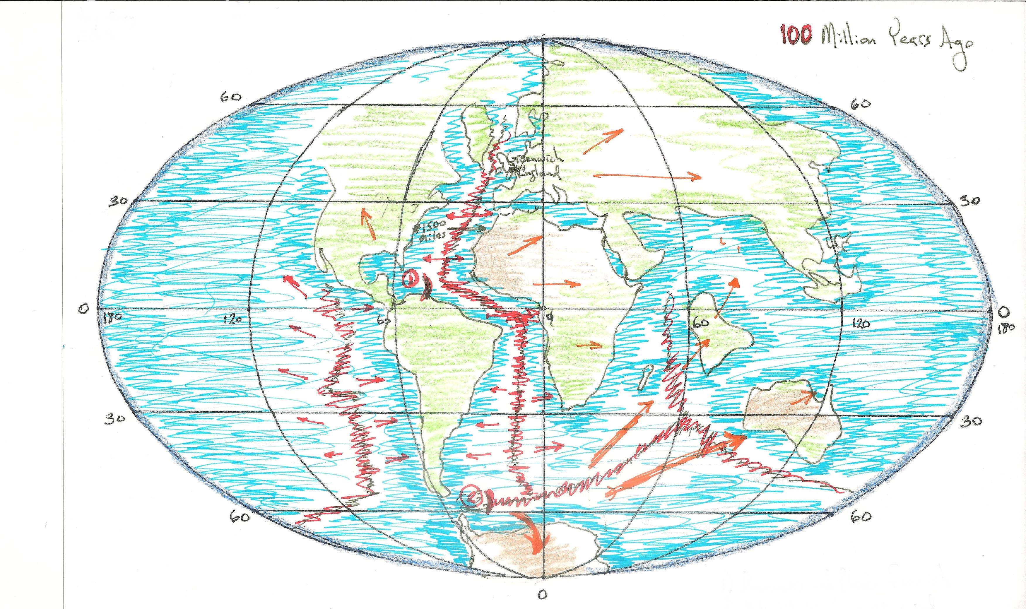
On GoogleEarth, You can still see the path of India traced into the Earths’ crust almost due north from the impact area. Australia travels east just as ‘quickly’ (note: with no subduction forces to pull it?).
This new theory also would give the same tectonic plate movements as current animation videos show, but once again, it gives a reason for the movement. The “extinction events” caused by these meteors are noted in the geological record. The “event” caused by the second meteor is lessened because it strikes so far south of the equator, just far enough away from where most of the new life forms seemed to be rapidly developing. There is a crack in the Earth’s crust running due east from the eastern rim of the Scotia Plate. This fracture line points towards India and Australia. It implies IMPACT. It implies life changing events.
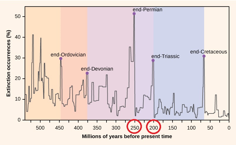 < Extinction Event timeline
Other theories have the massive forces begin rather ‘suddenly’, due to the forces of volcanic ‘Super Plumes’, (which surge upward, not directionally) and also… possibly due to the ‘suctional’ pulls of subduction zones. The physical evidence shows that both India and Australia must have been moved with directional FORCE.
All animations of the Pangaean break-up event (many are available on the Web) run ‘as if’ they have been hit by something. But, there seems to be an aversion to the discussion that Earth might have been struck by meteors “of note” more than just a few times – and even then, it is limited to “little” ones. Current science notes only ONE strike of significance, at about 65 million years ago! – I’m only proposing two more – and each nearly 50 million years apart (and only a few hundred million years earlier).
Both meteors left ample physical evidence of their passing when viewed from the GoogleEarth perspective. This mapping detail did not exist 20 years ago, and almost all current tectonic theory was developed in the period from 50 – 20 years ago (just beginning in the mid-1950’s).
We have new tools – they can bring simpler, or more complicated, explanations – they can also bring answers. And, if my theory is correct, these related questions have come to mind:
Could the direction and shallowness of the impacts have altered the rotational speed of the earth – since they all seem to be directed in a way that would impart additional energy to our rotation? If so, did the length of an earth day shorten about 200 million years ago?
Could the southern, Scotia strike (2) be responsible for the wobble in our ‘spin’?
If they succeeded in increasing our rotational speed, are they responsible for setting up the North and South-pole climatology effects – as in, centrifugal force creating low pressure at the poles, where cool air can pool?
Also, here is something that is usually left out of the discussion: Our solar-system consisting of the Sun and its local planets, does not sit still in space. It orbits around the outside edge of the Milky Way Galaxy, on a nearly 250 million year circular journey. Our Earth has completed this epic odyssey roughly 20 times during its +5 billion year history. The time frame is called a Galactic (or Cosmic)Year, and I feel certain that in that vast of an amount of time and distance, our “own” planetary system passes through much larger asteroid fields than the “smaller”, but still very dangerous “local” meteoric encounters.
******** ****** ****** ***** ******
Here I must note that so far, my correspondence with the School of Geological Sciences, at the University of Colorado at Boulder, has not been in the favor of my Theory. The objections are as follows: 1) Plates have no momentum. 2) there would be evidence of a portion of the oceans being boiled away by such large impacts. 3) the deduced ages of the Caribbean and Scotia Plates are younger than the Paleozoic Era. 4) The core dating, and other physical rock data doesn’t back it up. 5) No rocks that size could have struck earth since 4 billion years ago…
All’s I can say is that I’m still looking at visual (and I understand it’s only visual), but a LOT of visual, evidence that doesn’t really align with that. So it’s taking my brain awhile to try to re-think it. Could meteors that size hit and not boil the ocean away? Do all meteors travel at the same speed – could some, traveling at a similar path and speed (even momentarily) just drop in (so to speak), without as much devastation – there is quite a bit of evidence for very slow entry speeds? see video the below:
http://phys.org/news/2014-04-video-norwegian-skydiver-falling-meteor.html
Great coverage of full story:
The Hoba Meteorite leads to similar questions: http://geology.com/records/largest-meteorite/
Just for discussion: Imagine taking a full size globe off of your desk, taking it outside and hanging it by a thin line from the branch of a tree. You fill the core of the globe with hot asphalt, but with the surface being cool enough that water does not boil away. Then move all the continental plate pieces, of granite, basalt, and etc., back to the little island they were originally assembled into 250 million years ago – Pangaea. We now have a physically representative globe of Pangaea hanging from a tree. Step back about ten paces and fire a 22 cal bullet at Pangaea. First, I’ll point out that it’s speed ratio would be much slower than that of the “average” meteorite – be as noted above, some comets “catch” us, from behind or from different angles, and their incoming speeds are slower – maybe no atomic blast? ASSUMING a slower meteorite impact, what happens to Pangaea? Does it split? fracture? does the bullet leave a scar and sink into the “interior”? If Pangaea fractures, how would the pieces react across a semi-solid, hot, sub-surface? What are the physics?
And, I’m still wondering if SOME plates have momentum? India? This is how the CU physics department presents the event. I wish they would have had the animation running the proper direction, time-wise, then it would look exactly like I propose in the theory! The plates move away from a particular area (note the area), in reaction to a particular event.

and this:
http://www.pbs.org/wgbh/nova/eden/media/sttnq.html
